
DEVELOPING THE EXZECO METHOD AS PART OF THE COSPARIN PROJECT, AND APPLYING IT IN THE INDIAN OCEAN
The COSPARIN project1, led by the company Predict Services, seeks to devise novel products that use satellite data as a basis for estimating flood-prone areas, thanks to the innovative ExZEco method developed by Cerema.
The need
The core business of Predict Services is risk prevention and management. The company supports individuals, companies, local authorities and crisis management services, in France and abroad, in their decision-making process before, during and after a risk phenomenon. Its purpose is to "Support resilience and adaptation to climate risks through human expertise and scientific excellence, for a sustainable and inclusive future."
In order to develop its international activity, promote French expertise and respond to the initiative by the United Nations and the World Meteorological Organization (WMO) to have early warning systems in place worldwide within five years, Predict Services has a pressing need for rapidly available, accessible information on flood-prone areas.
The partnership
Predict Services and Cerema are taking action on crisis prevention and management in France. For some years, Cerema has been developing various approaches for learning about flood-prone areas, gathering both detailed and large-scale data that Predict Services also uses.
In the context of improving its international-focused solutions, Predict Services has proposed and initiated a project funded by the European Space Agency (ESA). Cerema and Météo-France have contributed to this project in order to devise new data that will help optimise Predict Services' expertise.
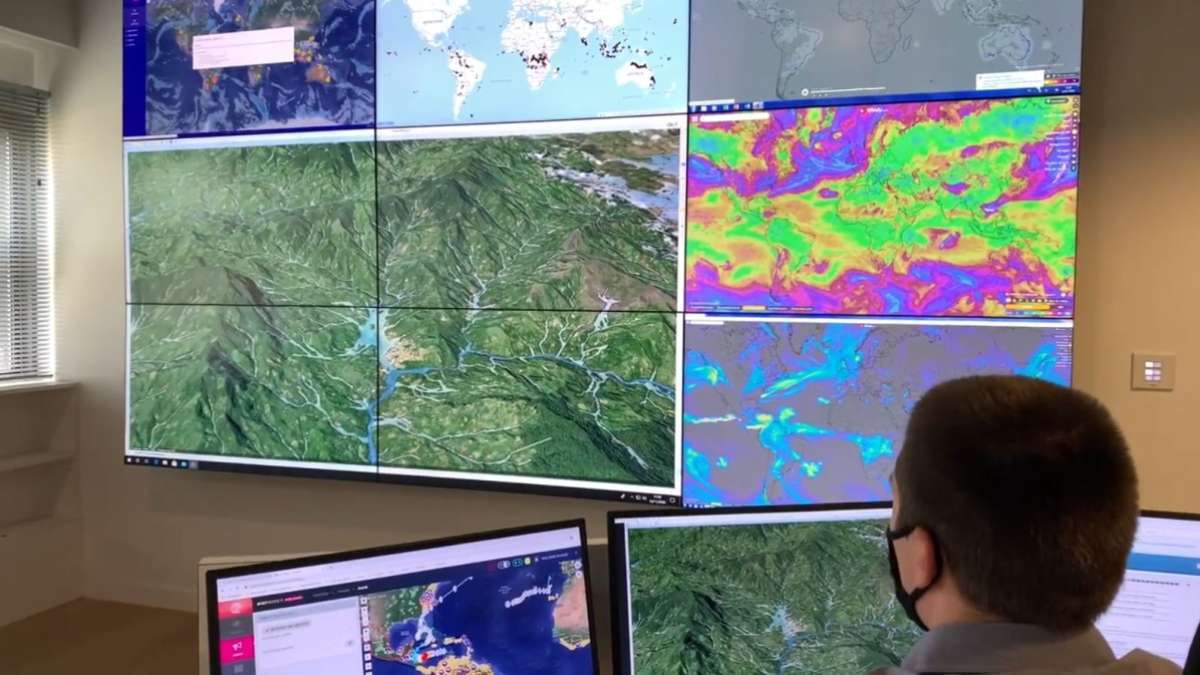
Cerema's research activities for this project are centred on rapid knowledge-gathering about large swathes of flood-prone areas.
The innovation
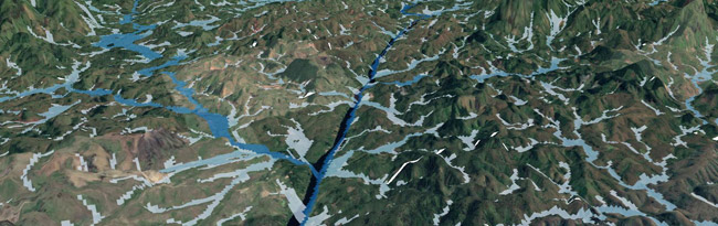
Cerema has designed an innovative method called ExZEco, corresponding to the French Extraction des Zones d’Écoulement which means "Extraction from Flow Zones", to map parts of small catchments that are at risk of flooding. This method, the fruit of research activities, was initially used for the Floods Directive in 2011, basing its calculations on Digital Terrain Models (DTM) using 25-metre intervals. The method was subsequently applied to many territories in France, and particularly 20 regions of Mediterranean arc countries, where precise DTM (5-metre intervals) was used after flash flooding in the Cannes area in 2015.
The COSPARIN project is innovative in that it integrates global DTMs into the application, transforming data from the Cartesian format to the WGS 84 – World Geodetic System 1984 – reference system. The parameters have been reset so that the method can utilise lower-quality DTMs (intervals of 12 to 30 m) on the one hand, and be extended automatically to larger catchments on the other.
These improvements have been tested successfully in Madagascar (650,000 km²) and on many islands in the Indian Ocean.
The demo version has been made available to end-users in the Indian Ocean.
1Acronym in French for SPatial COntribution on Flood Risk Analysis
A partnership
![]() Institut Carnot Clim’adapt is developing partnership-based research, i.e. management of research work conducted by public sector laboratories in partnership with socio-economic players, businesses of all sizes and local authorities, in order to meet their needs.
Institut Carnot Clim’adapt is developing partnership-based research, i.e. management of research work conducted by public sector laboratories in partnership with socio-economic players, businesses of all sizes and local authorities, in order to meet their needs.
By making use of Cerema’s exceptional resources and regional coverage relating to research, engineering, expertise and equipment, Clim’adapt supports its partners to enable them to transition to a resource-efficient, carbon-free, environment-friendly economy, linked to new life styles engendered by digital transition and adaptation to climate change.
Discover Institut Carnot Clim'adapt